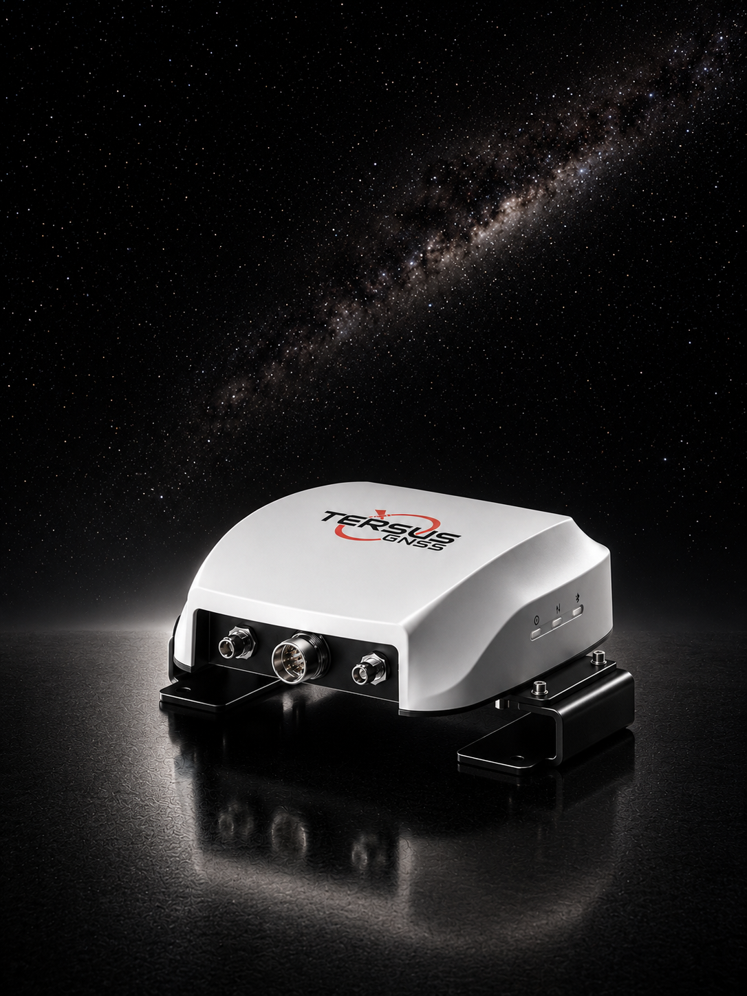
GC30
High-precision navigation platform for agricultural OEM systems.

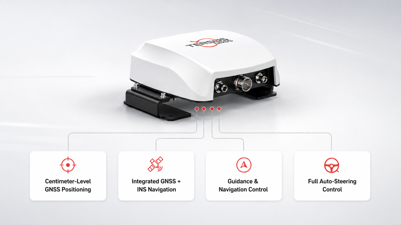
Key Advantages at a Glance
Core Features for Modern Field Workflows
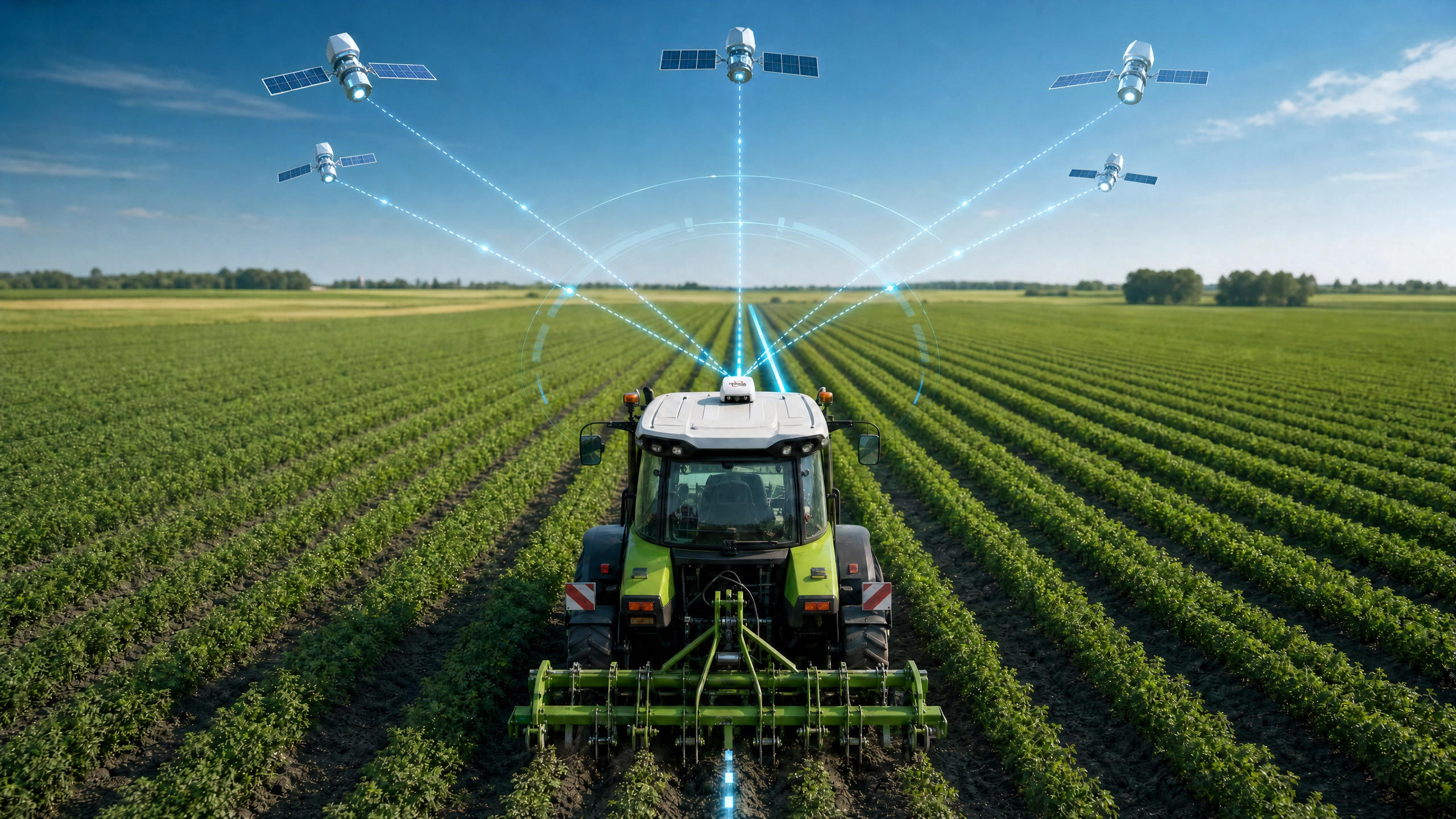
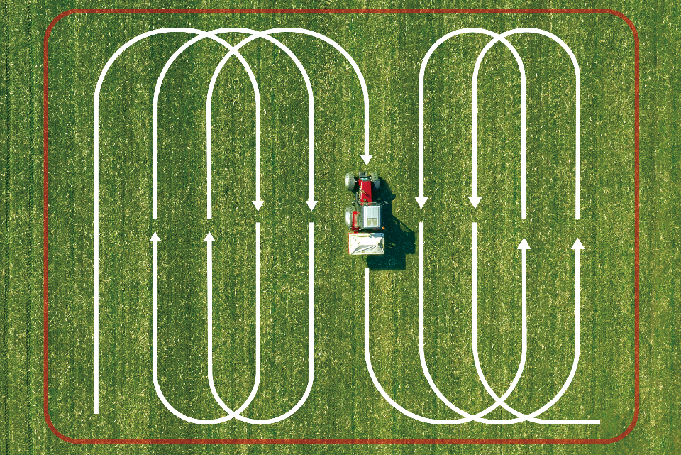
Multi-Constellation, Centimeter-Level Accuracy
GC30 delivers highly accurate positioning by tracking all major satellite constellations, including GPS, GLONASS, BeiDou, Galileo, and QZSS. With centimeter-level RTK performance, it provides the precision required for modern agricultural guidance, helping machines operate more accurately and efficiently in the field.
- Supports all major global satellite constellations
- Centimeter-level RTK positioning accuracy
- Improved signal availability in complex environments
- Reliable guidance for precision farming operations
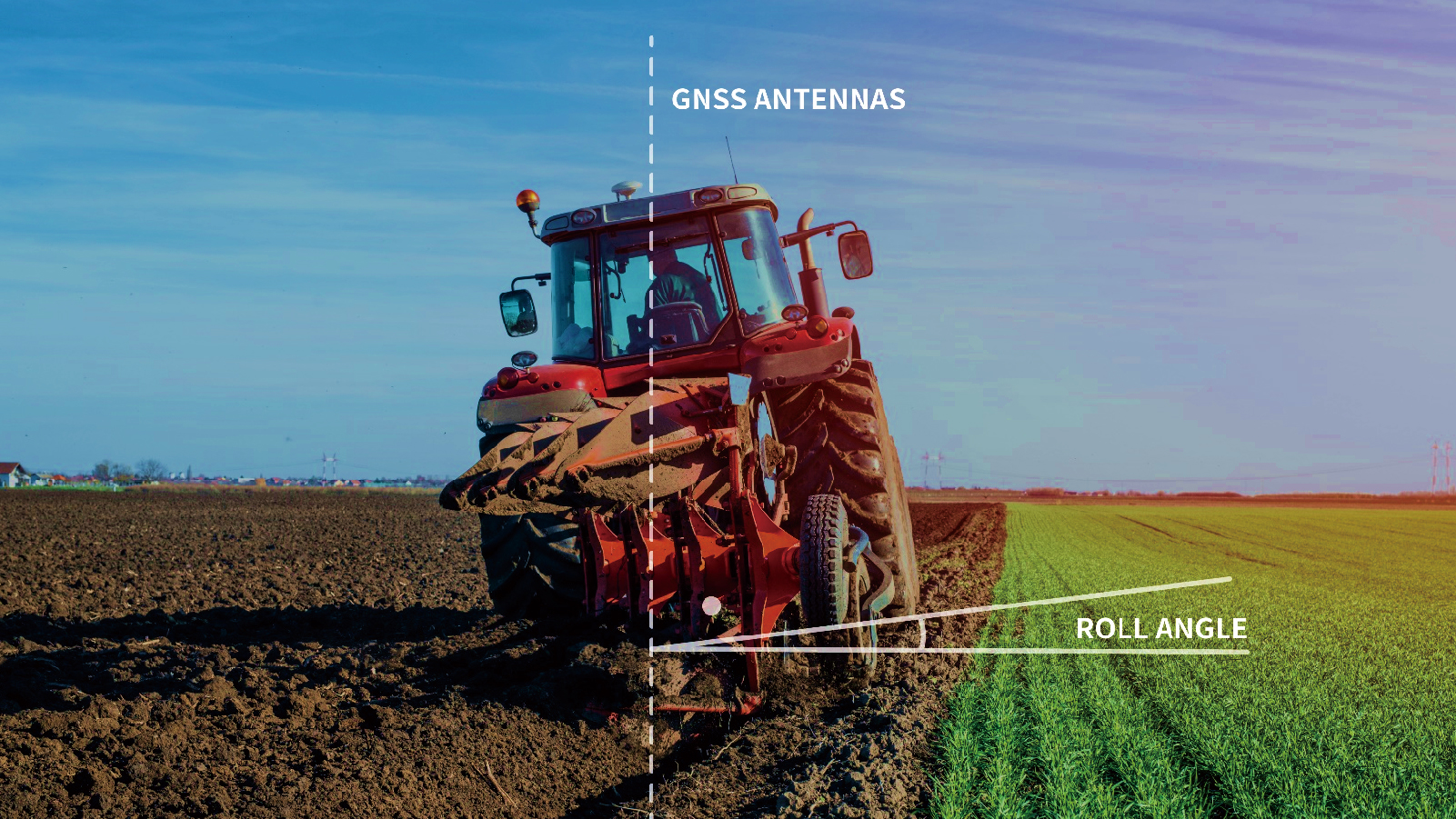
Stable Navigation with Integrated GNSS and INS
With a built-in high-performance IMU, GC30 combines GNSS and INS technology to provide stable roll, pitch, and heading information in real time. Even when satellite signals become weak or temporarily unavailable, the system helps maintain smooth and reliable navigation performance.
- Built-in IMU for continuous attitude sensing
- Real-time roll, pitch, and heading output
- Reliable performance during signal degradation
- Better stability in dynamic field conditions
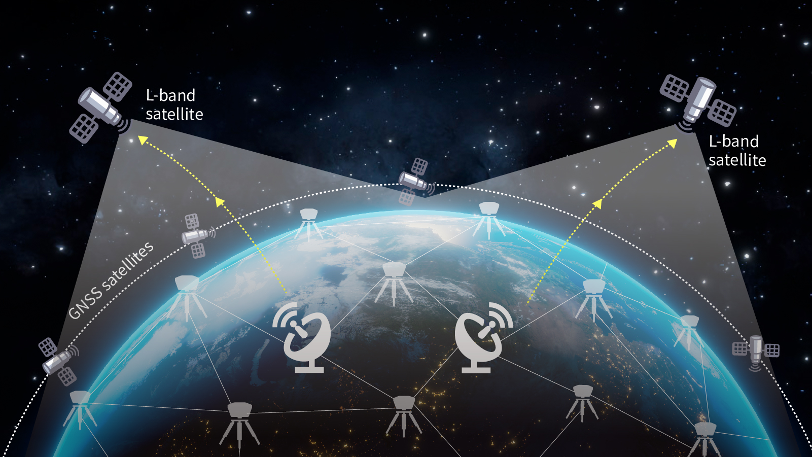
High Precision Positioning with TAP Service
GC30 supports TAP service, enabling high-precision positioning through L-band satellite correction delivery. Unlike traditional RTK solutions, TAP does not rely on a local base station or CORS network, and no radio or internet link to a correction source is required. This allows manufacturers and users to achieve reliable high-precision performance with a simpler deployment architecture, especially in wide-area agricultural operations.
- Supports TAP PPP correction service
- Receives correction data directly via L-band satellite
- No local base station or CORS dependency
- No radio or network connection to a correction source required
Flexible Integration for OEM Applications
GC30 is designed to support different levels of OEM integration, from high-precision positioning to full navigation and steering control. This flexible architecture allows manufacturers to select the solution level that best fits their machine platform, development plan, and market needs.
- Four levels of OEM integration
- From positioning only to full control capability
- Easier system adaptation for different machine types
- Scalable solution for diverse product strategies
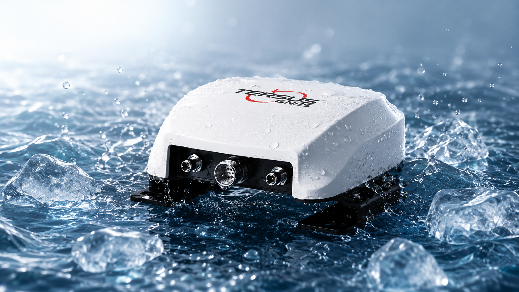
Built for Harsh Agricultural Environments
Engineered for demanding field use, GC30 features a rugged industrial design with IP67 protection and a wide operating temperature range from -40°C to +70°C. It is built to withstand dust, water, vibration, and challenging outdoor conditions, ensuring long-term reliability in agricultural applications.
- IP67-rated protection
- Operating temperature from -40°C to +70°C
- Robust design for agricultural machinery
- Reliable performance in harsh outdoor environments
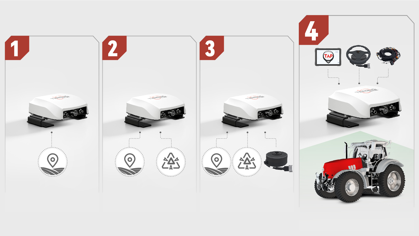
Integration Options
GC30 supports multiple integration paths to match different product strategies, development capabilities, and time-to-market needs.
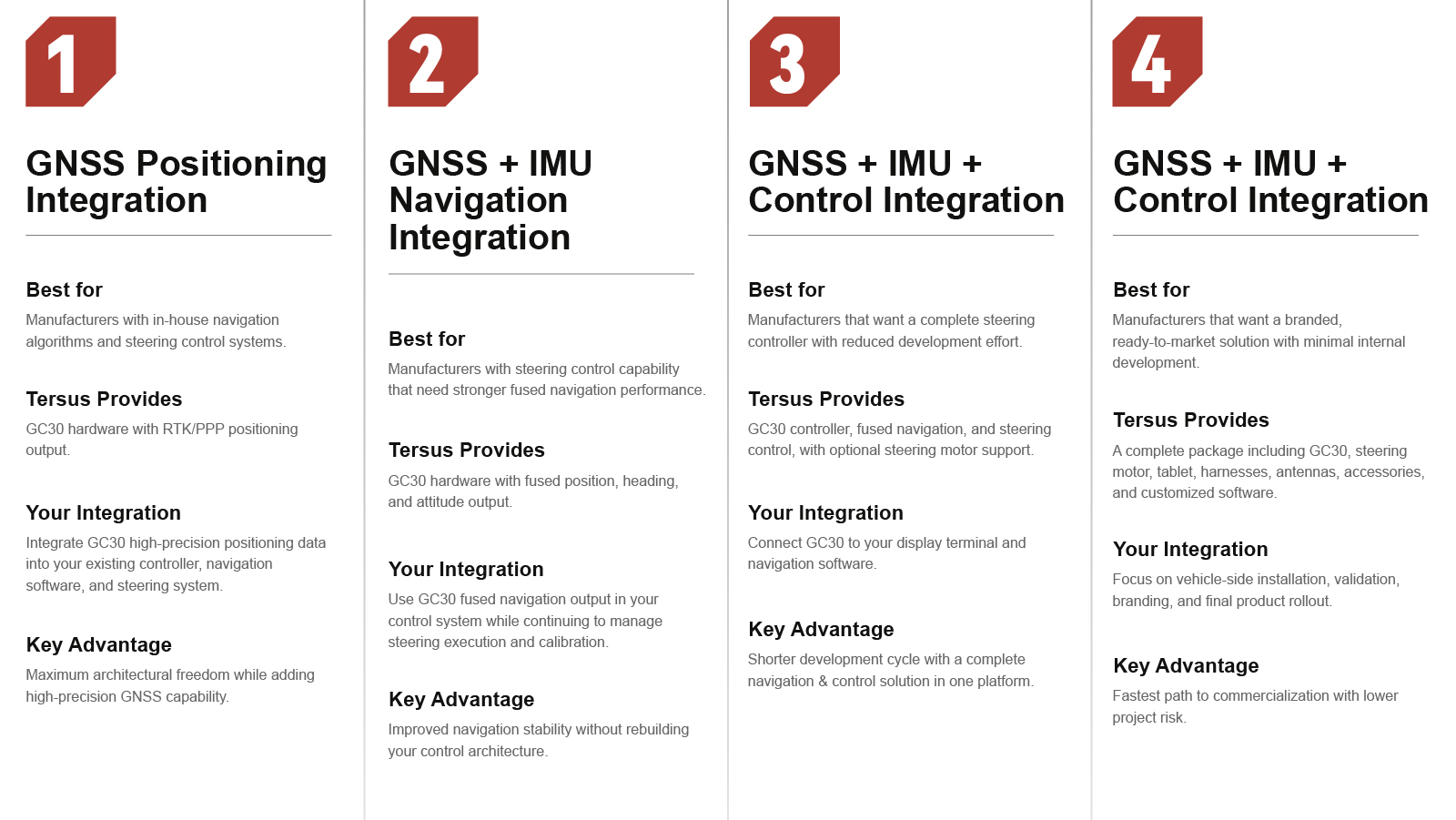
Integration Options
GC30 supports multiple integration paths to match different product strategies, development capabilities, and time-to-market needs.
Built for Real Field Workflows
Tractor Auto-Steering
High-precision positioning and stable heading for accurate automatic steering in the field.
Precision Guidance
Reliable navigation for tractors, sprayers, and other agricultural machines to improve field efficiency.
Autonomous Machinery
Integrated GNSS/INS navigation for autonomous and intelligent agricultural equipment.
Retrofit & Smart Farming
A flexible OEM solution for retrofit steering kits, smart farming equipment, and agricultural robots.
Technical Specifications
Core capability
Integration modes
Industrial readiness
Product Resources
Frequently Asked Questions
Who is GC30 designed for?
GC30 is designed for agricultural equipment manufacturers and integration partners building guidance, navigation, or auto-steering products.
Can GC30 be used without a local base station?
Yes. GC30 supports TAP, which provides high-precision positioning without requiring a local base station in supported deployment scenarios.
Does GC30 require the partner to build steering control?
Not always. Partners can use GC30 only for GNSS output, use it for fused GNSS and IMU navigation, or deploy it as a complete steering controller depending on their system architecture.
What kinds of machines can GC30 support?
Typical applications include tractor steering systems, guidance terminals, retrofit kits for sprayers or tractors, and other smart farming or agricultural robotic platforms.
Ready to Build a Faster Field Workflow with GC30?
Talk to our team for pricing, demo support, technical evaluation, or distributor cooperation.