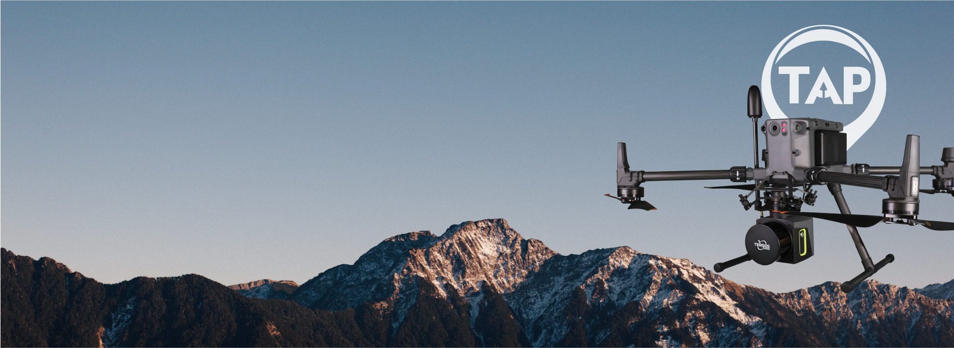

Fly Light. Map Right.


3–5 cm Accuracy
Survey-grade precision with PPK


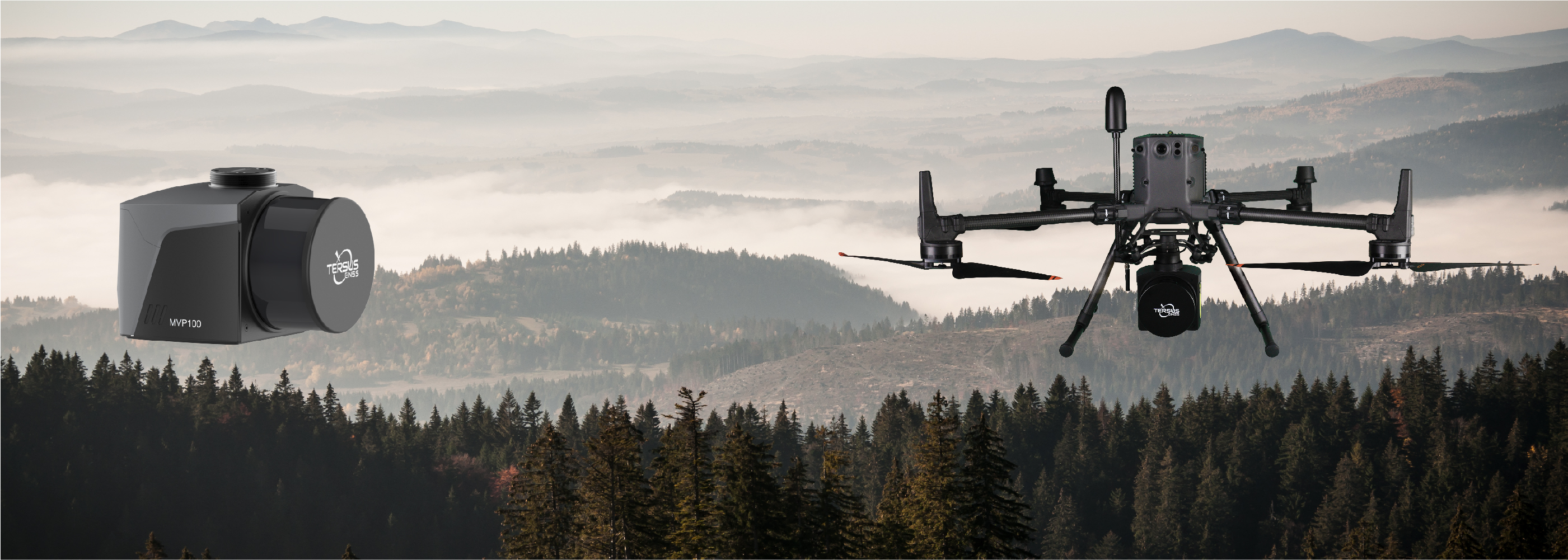
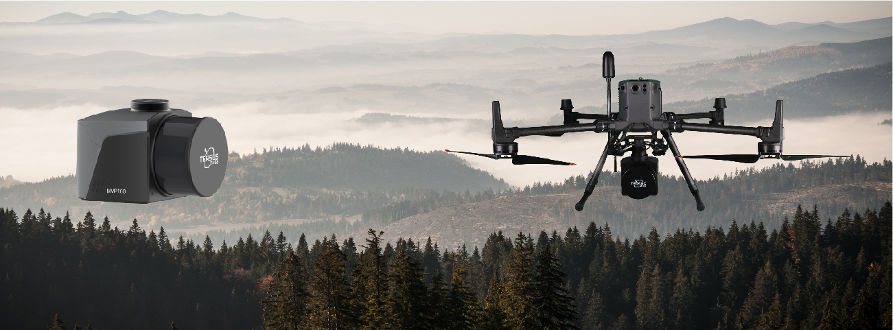
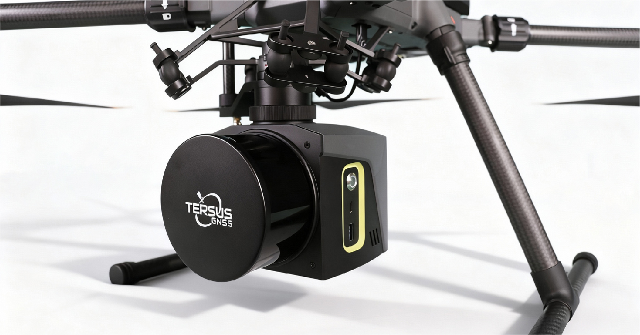
All-in-One Payload
LiDAR, camera, GNSS, IMU integrated


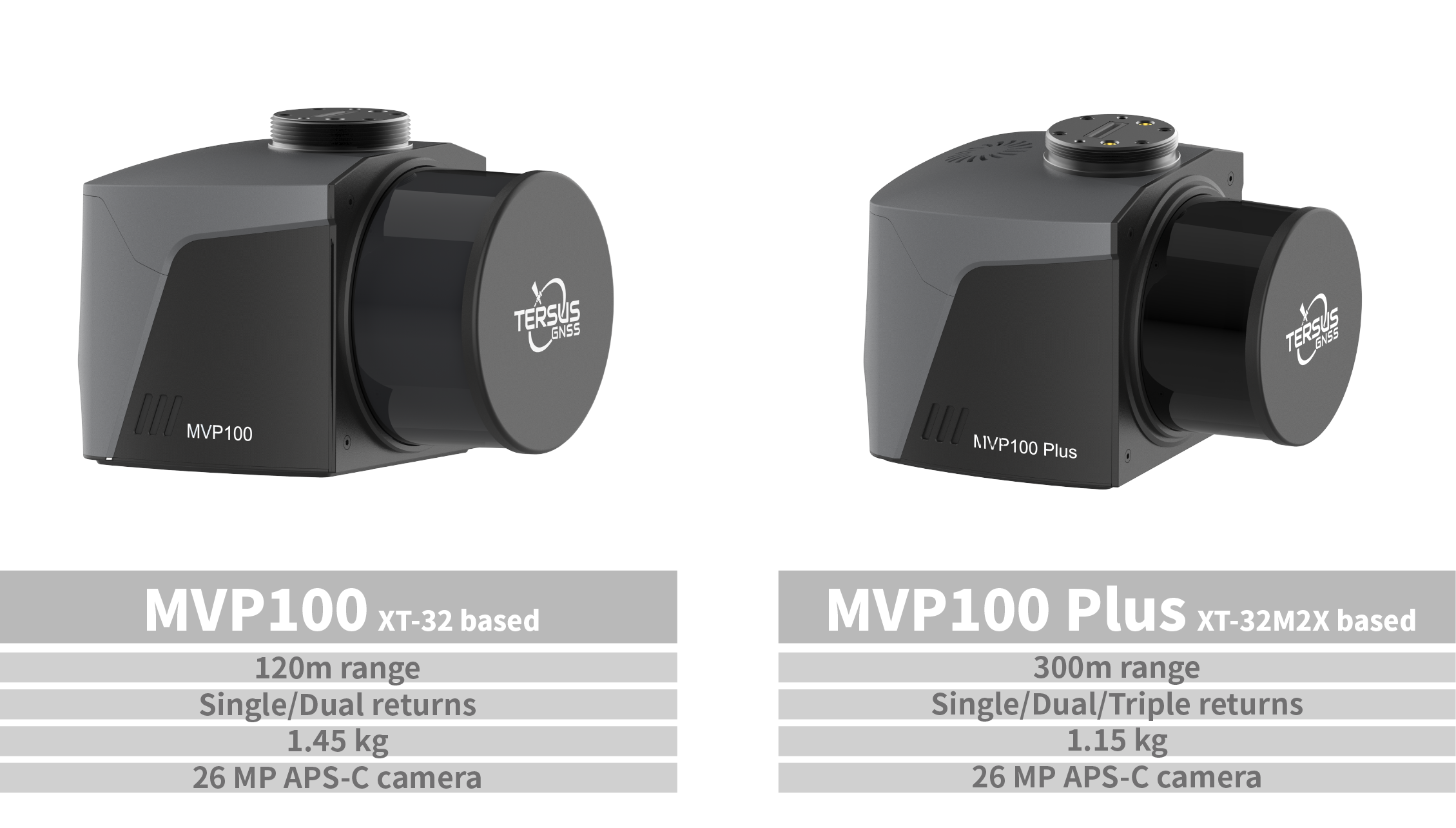
Triple Returns&300 m Range
Reliable ground extraction on Plus


Powered by TAP (PPP)
Base-Station-Free Workflow
Survey-Grade Accuracy
Typical absolute point cloud accuracy of 3–5 cm with PPK, with LiDAR measurement accuracy of 10 mm and precision of 5 mm, delivering reliable survey-grade results.

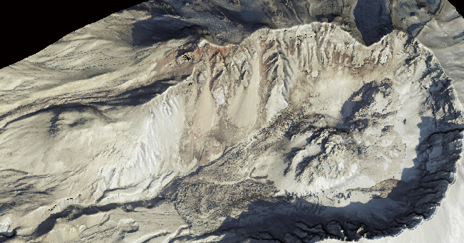
Exceptional Penetration
With triple returns and a detection range of up to 300 m on MVP100 Plus, the system reliably extracts ground points beneath dense vegetation and complex terrain.

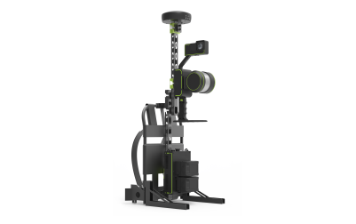
Lightweight & All-in-One
Weighing only 1.15–1.45 kg (including camera), MVP100 integrates LiDAR, camera, GNSS, IMU, onboard storage, and DJI SkyPort into a single compact unit.
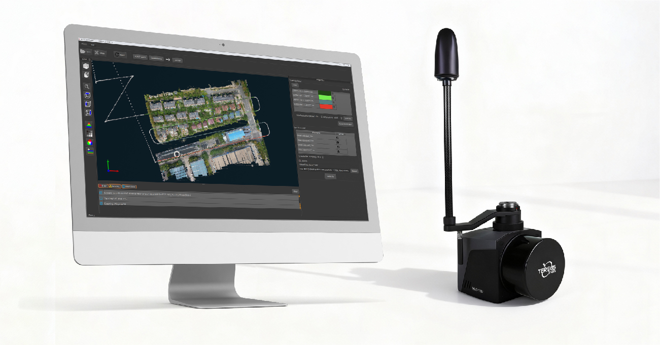
Efficient Workflow
One-click processing in Tersus MVP Engine streamlines trajectory calculation, georeferencing, and point cloud optimization. TAP enables base-station-free mapping for faster, more flexible deployment.
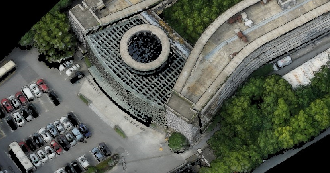
Digital models are commonly used geospatial results generated by LiDAR Mapping System. These products are widely applied in terrain mapping, monitoring and reconstruction.
Extremely precise 3D LiDAR data for purposes like analysis of road infrastructure, locating light poles and traffic signs, new planning and asset management.
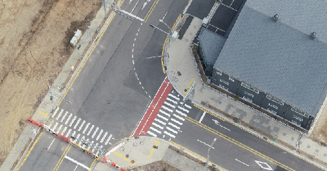
In building construction and infrastructure, MVP offers detailed and accurate point cloud data for smart cities, street mapping, and BIM.
Provide detailed information on forest structures, including tree height, diameter, volume, leaf area index, etc. Also efficiently obtain under-tree ground surface information for digital models.
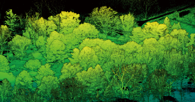
Efficiently acquire dense point clouds for detecting downed power lines, hazardous trees, and other potential hazards.
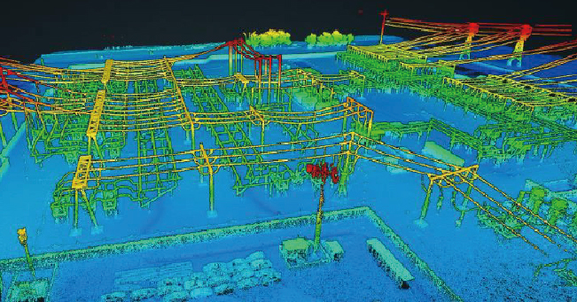
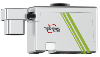
MVP is a mobile mapping system that can rapidly capture rich geospatial data while mounted on mobile platforms. As a cost-effective and high-precision mobile mapping application, it utilizes the high-performance GNSS-aided inertial navigation system (INS) and Tersus's patented GNSS receiver. You can choose between two models available, both of which can meet different requirements in the field.
-
MVP100_brochure_EN_20251215_v1.2
Release Date: 2026-01-04 Version:1.3