Instant Capture,
Instant Survey
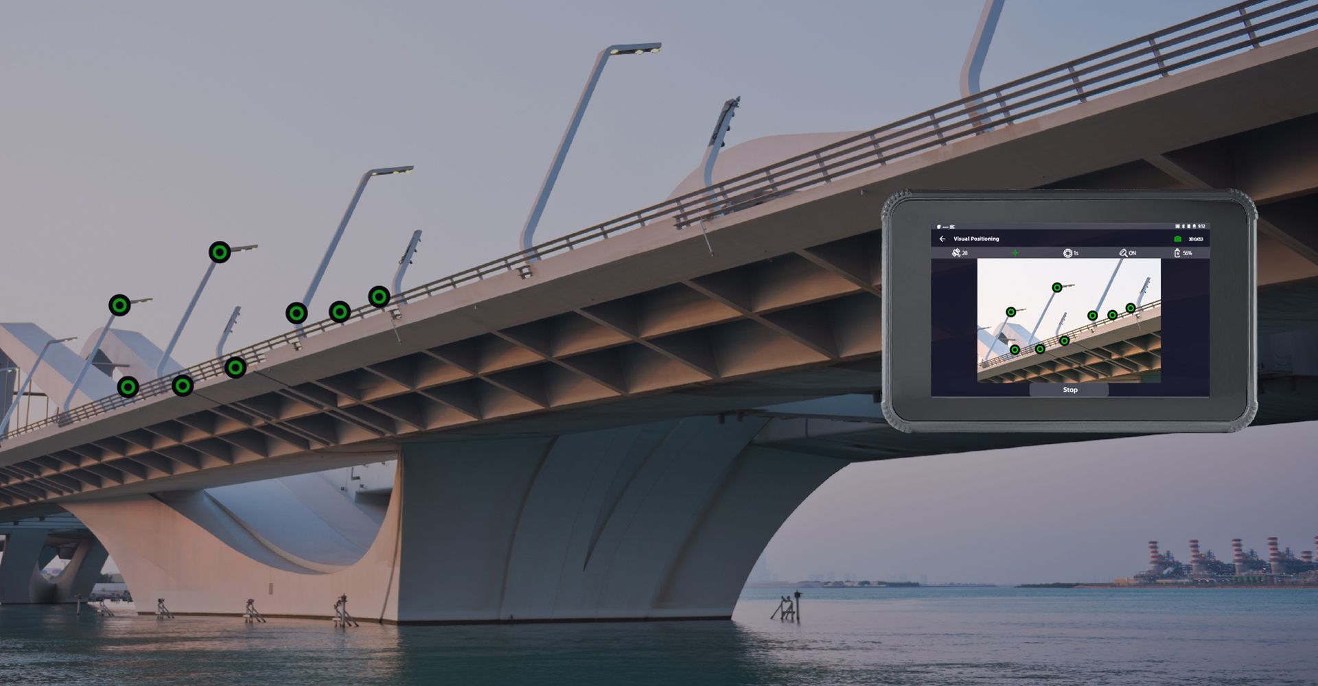
From image to coordinates
Real-time precision
Measure what you see
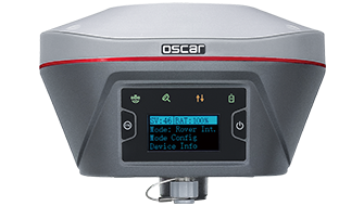
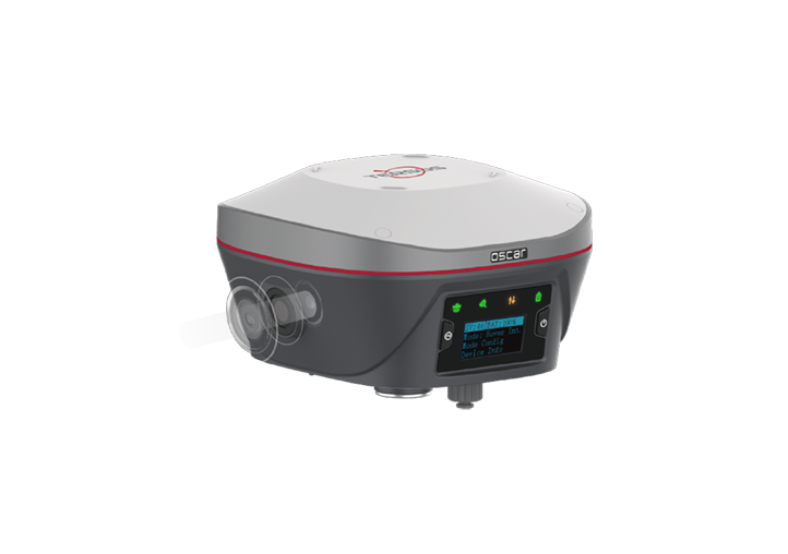
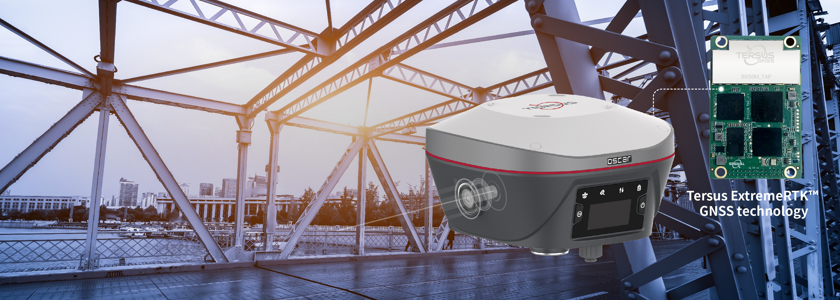
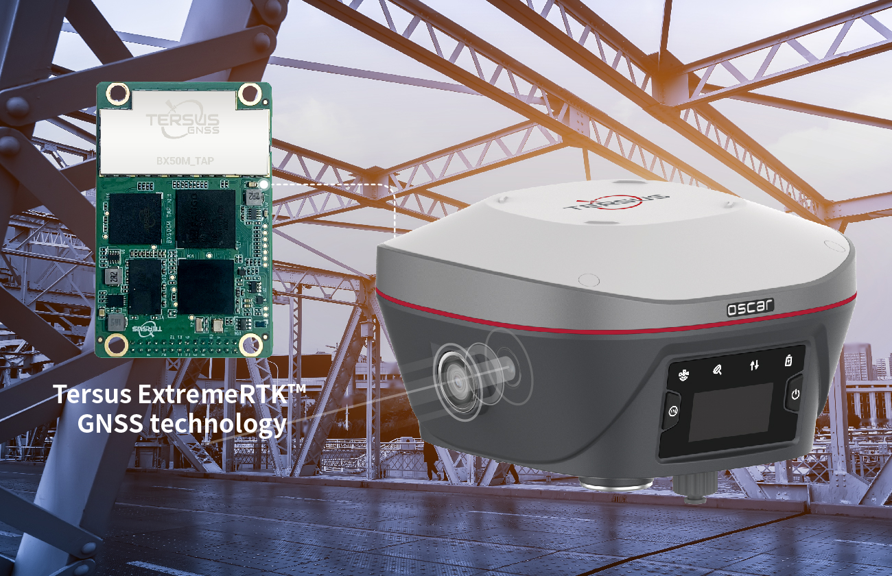
Oscar-Trek, Tersus's premier visual RTK product, integrates a
high-definition camera, lMU, and GNSS for effortless non-contact measurement. lts user-friendly design enhances efficiency,
making it ideal for engineering surveying.
Fastest Visual Surveying RTK in the world
Oscar Trek processes images in real-time, providing precise coordinates instantly without any extra steps.
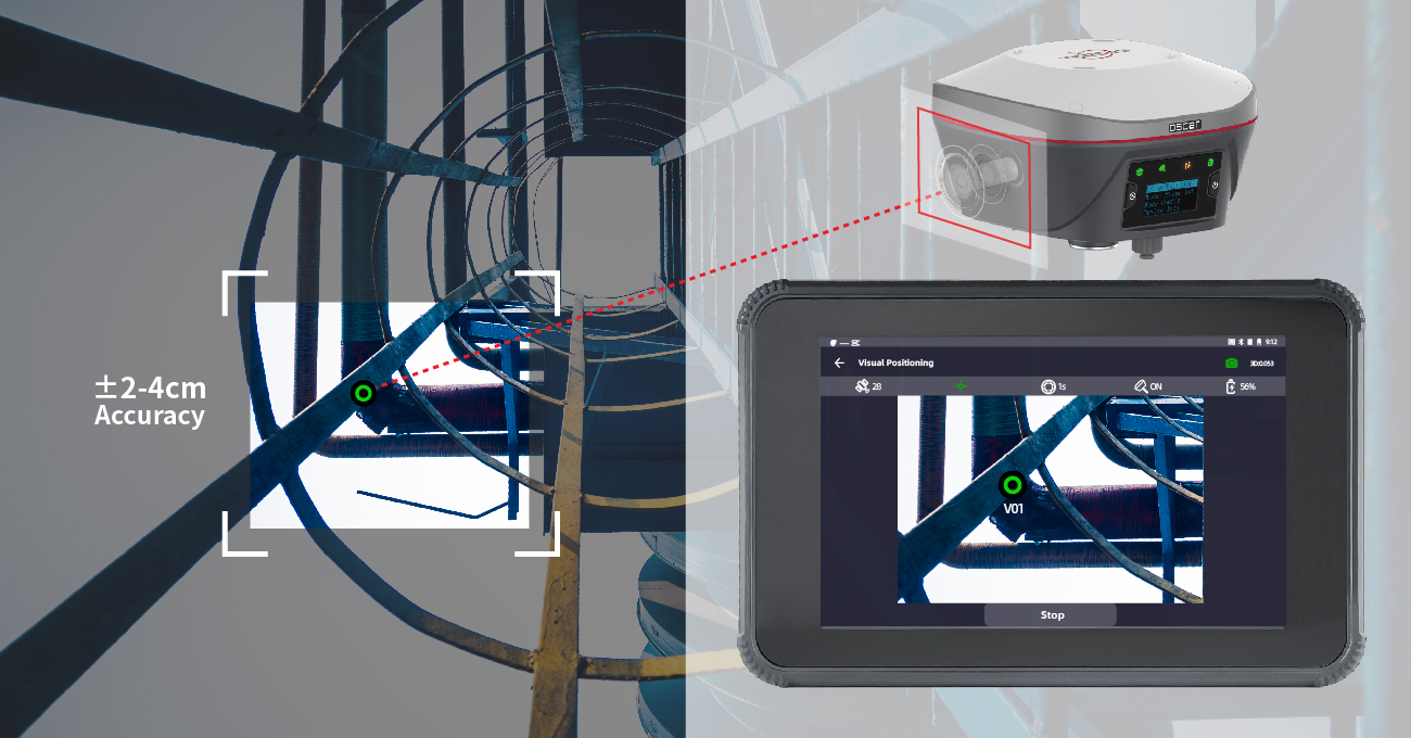
Accuracy Assured
A high-performance global shutter camera, low-distortion lens, and advanced algorithms deliver 2-4cm accuracy for point measurements, with built-in quality checks ensuring reliable results.
Simple Workflow
Pick, check, adjust, and save data easily, reducing time spent on fieldwork and data processing.
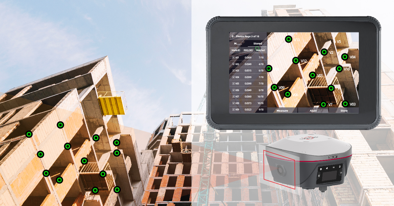
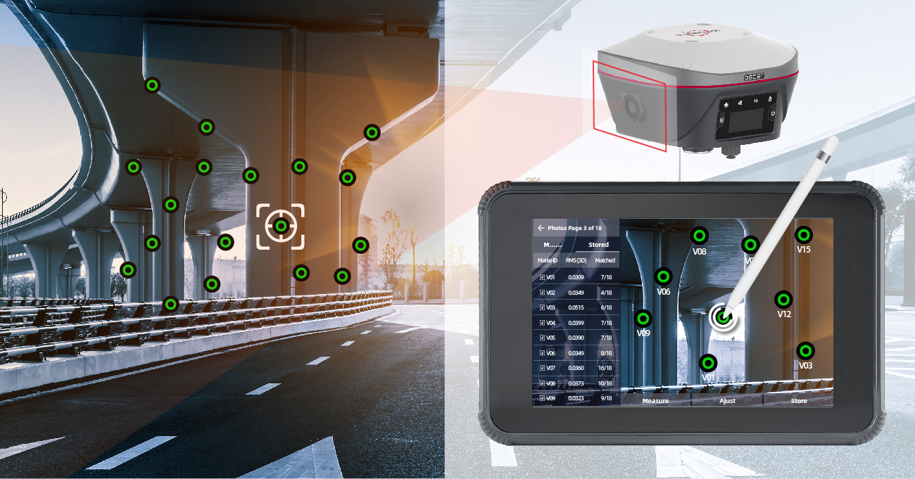
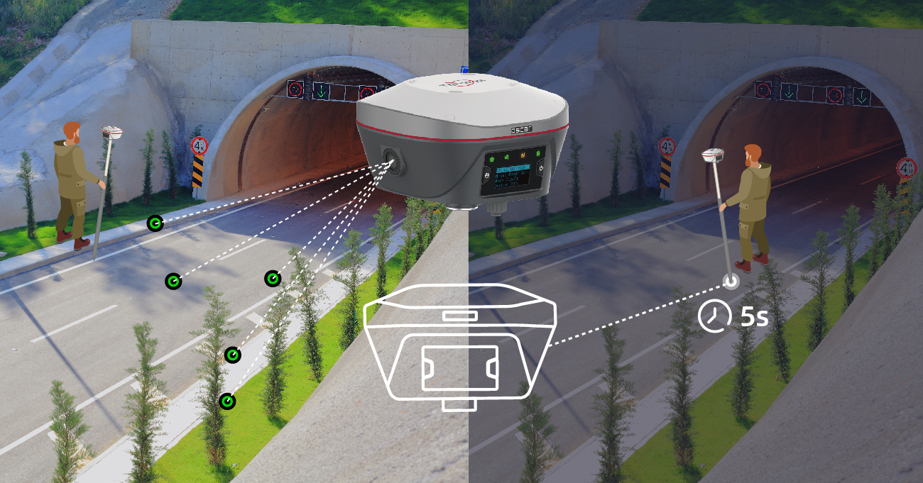
Multi-points a time
Pick many points in one image and measure, speeds up the entire process, helping you complete projects faster and more efficiently.
Unlimited Flexibility
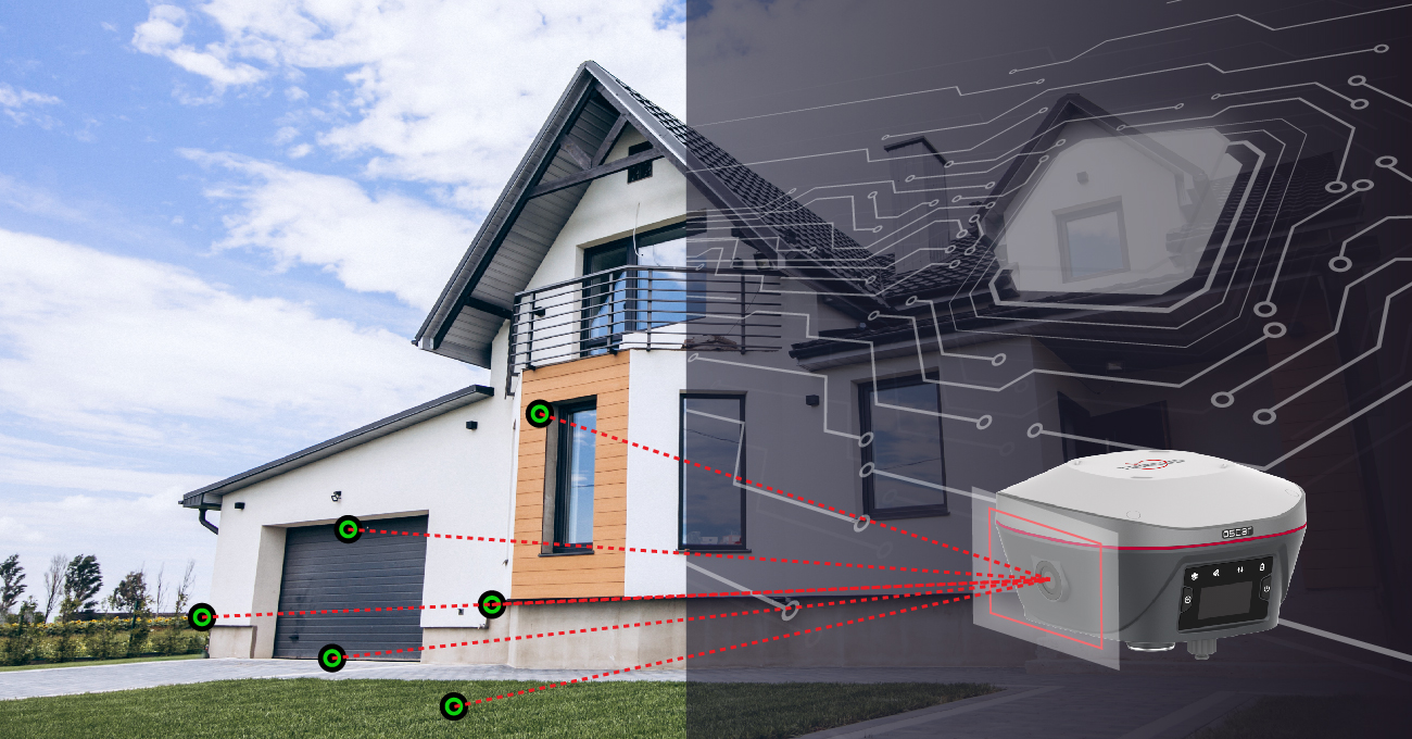
Measure in hard-to-reach places, making it perfect for challenging terrains where other GNSS rovers can't be used.
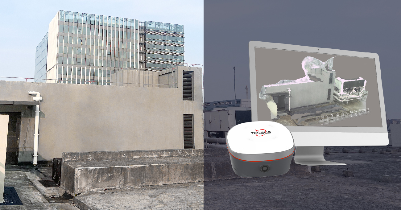
3D Modeling
Compatible with mainstream 3D modeling software and uses raw data to ensure accurate and flexible post-processing for creating detailed 3D models.
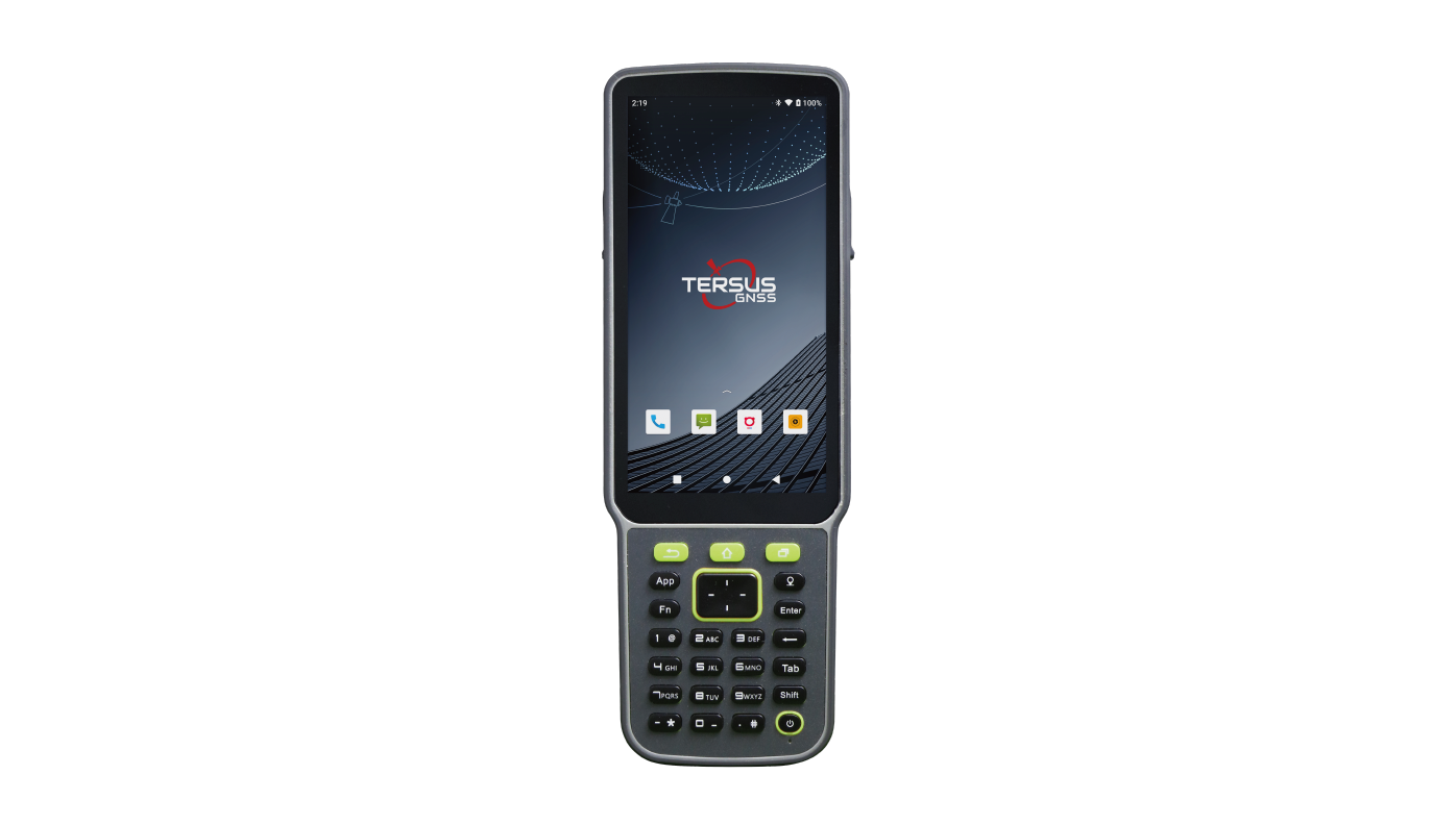
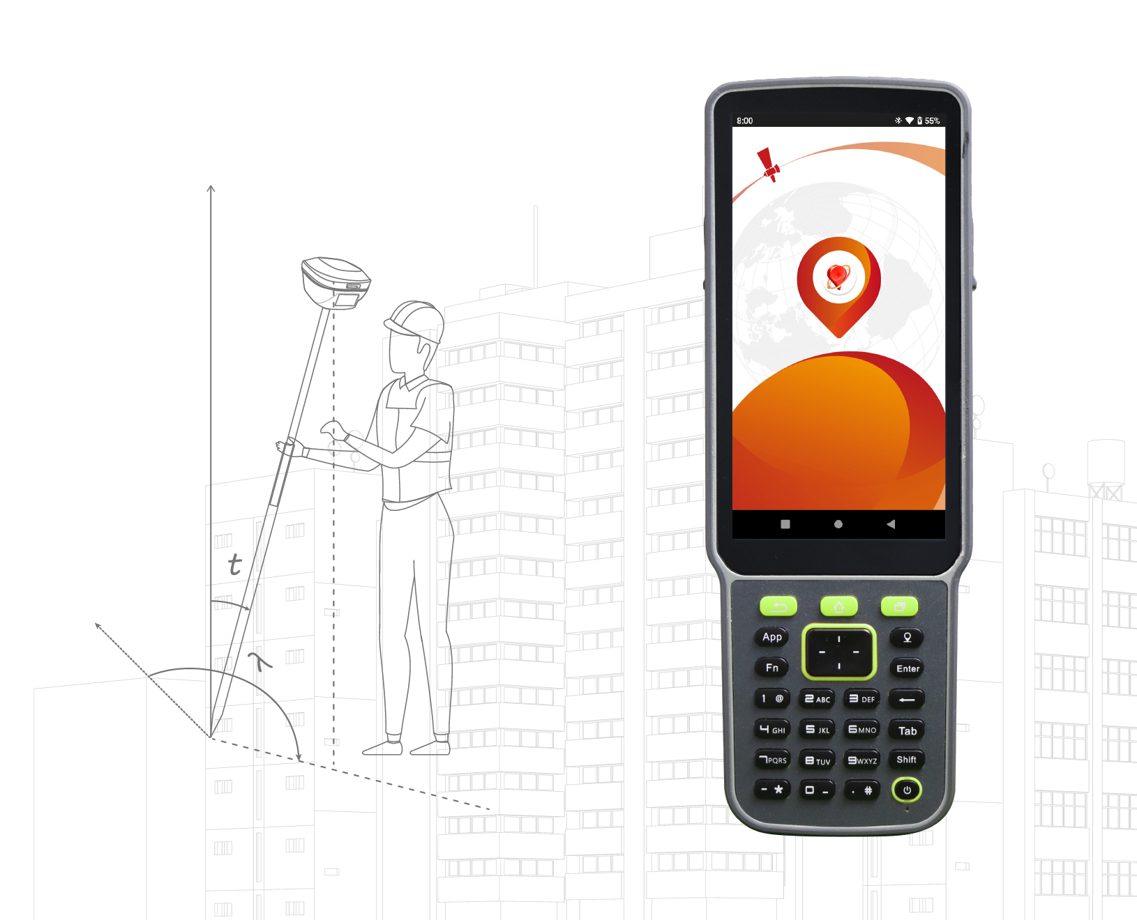
Data Collector and Field Software

The TC80 controller is a rugged multi-function data controller with a 5.5" sunlight-readable HD touchscreen design and alphanumeric keypad. It is equipped with a powerful octa-core processor and Android operating system, perfect for adapting to NUWA app, which is our versatile and FREE survey field software with easy-to-use graphical interfaces and powerful features.
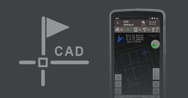
Supports direct import of various types of complex DWG and DXF files for staking of selected points and lines, as well as other more functions such as layer management, block operation, etc.
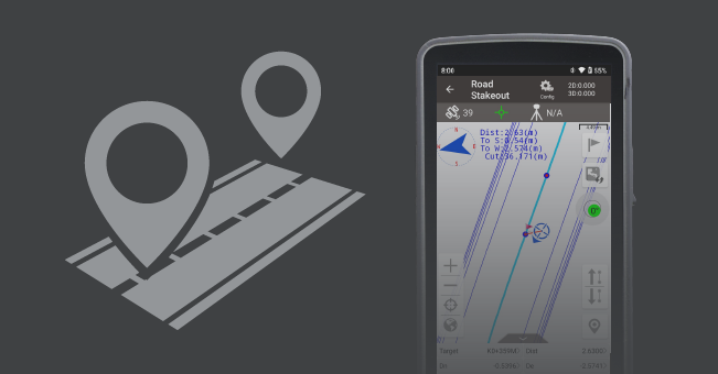
Supports importing, editing and previewing of roads in road management, as well as staking of road centerlines, cross sections and elevations in road stakeout.
Supports online maps like OSM and Google, as well as imported files like DXF, KML, KMZ and LandXML as base maps.

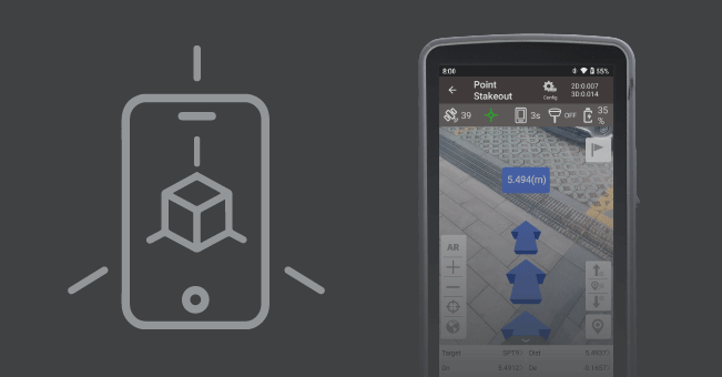
With the excellent tilt compensation of LUKA GNSS receivers, combined with the realistic view, the screen arrow will direct you to the point (without needing to orient to North first) to speed up the field work.
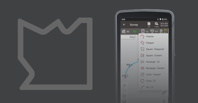
Visualization of graphic measurements, Nuwa will automatically connects the measurement points into the selected graphic, also switch between point survey and line survey based on the type of code.
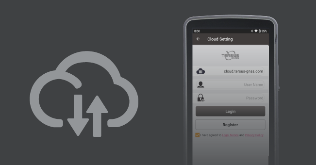
Project data backup and rapid collaboration, supports one-click synchronization of cloud and local data, also supports to export data to cloud, download and open on the desktop.
-
Datasheet_Oscar Trek_EN
Release Date: 2025-12-11 Version:2.0
-
Brochure_Oscar Trek_EN
Release Date: 2025-12-17 Version:2.1
-
Item List_Oscar Trek_EN
Release Date: 2025-11-24 Version:2.0
-
Quick Start_Oscar Trek
Release Date: 2024-07-03 Version:1.1
-
Test Report_ Visual Positioning for Oscar Trek
Release Date: 2025-02-07 Version:1.0
-
User Manual_Oscar Trek_EN
Release Date: 2025-12-17 Version:1.1
-
C02-C7 EMC 20251111
Release Date: 2026-01-05 Version:
-
C03-C8 RED
Release Date: 2026-01-05 Version:
-
Tersus 2AMDJ-TREK FCC Grant - DSS
Release Date: 2026-01-05 Version:
-
Tersus 2AMDJ-TREK FCC Grant - DTS
Release Date: 2026-01-05 Version:
-
Tersus 2AMDJ-TREK FCC Grant - NII
Release Date: 2026-01-05 Version:
-
Tersus 2AMDJ-TREK FCC Grant - TNB
Release Date: 2026-01-05 Version: