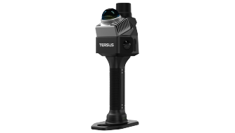

RTK-SLAM Technology


1cm /5cm Accuracy
Survey-grade accuracy.


RTK-SLAM
Al-driven RTK-SLAM.


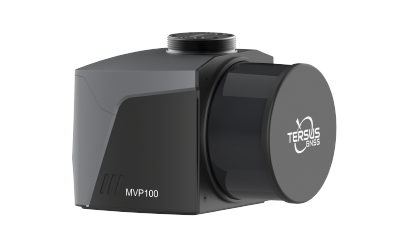
Vision
Dual 48 MP Panoramic Cameras.


3DGS
Supports 3DGS Reconstruction.
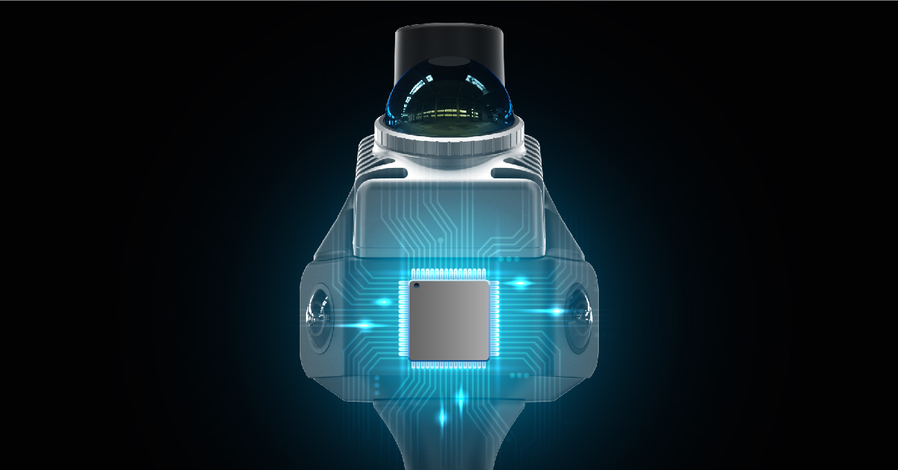
Robust RTK-SLAM
The Al-driven RTK-SLAM algorithm fuses LiDAR, vision, and GNSS data to ensure
TimeSync 3.0, True Microsecond Sync
Hardware-level multi-sensor sync achieves microsecond alignment, ensuring native data consistency and more precise, reliable fusion.
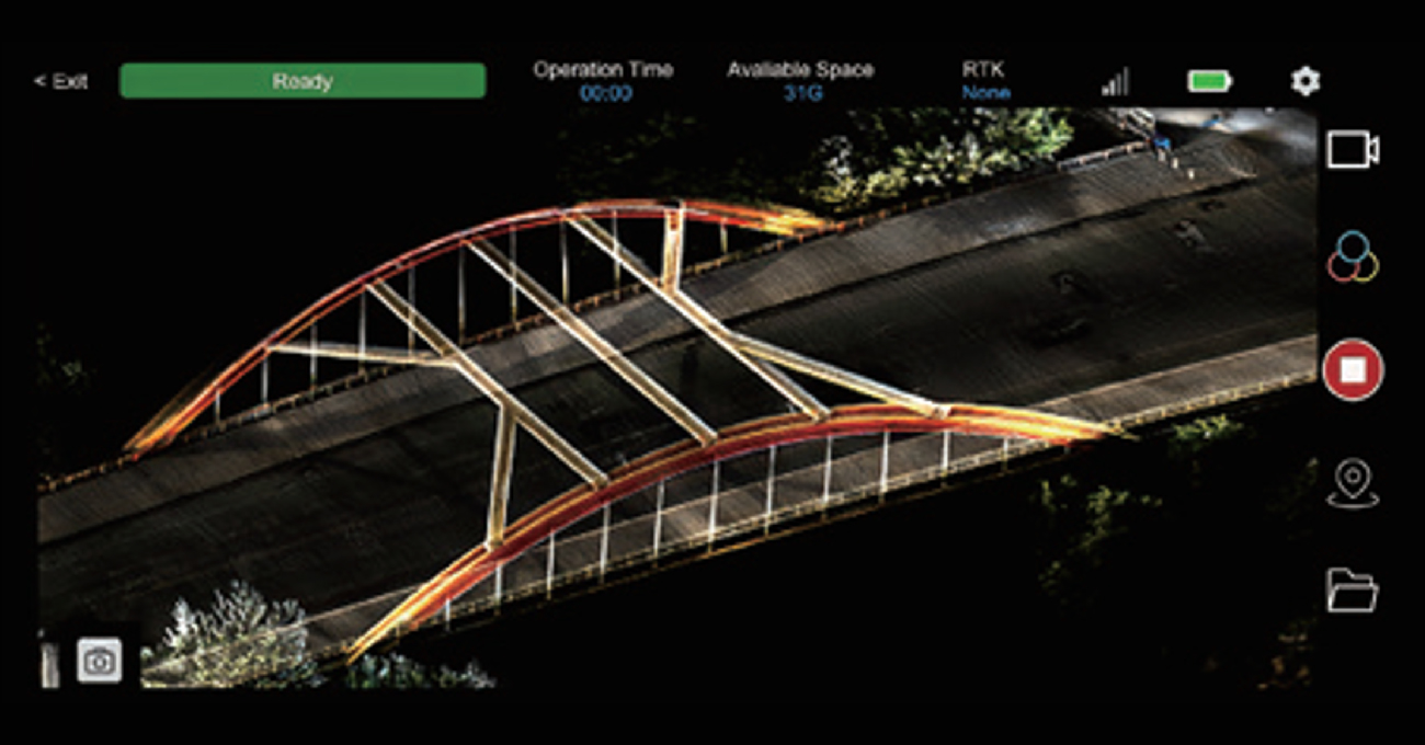
Real-Time Feedback
Preview colorized point clouds in real-time on your mobile device via the app. Generate scan reports instantly to verify data quality before leaving the site.
Photorealistic 3DGS
Equipped with dual 48 MP cameras, the MVP S1 captures stunning textures. Supported by 3D Gaussian Splatting (3DGS) technology, it generates not just point clouds, but photorealistic 3D models for immersive visualization.
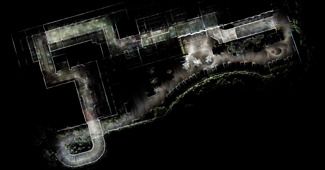
Accelerate your build with precise digital twins.
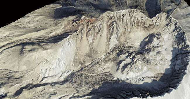
Capture current site conditions rapidly to verify as-built models against design. Streamline progress monitoring and quality control with millimeter-level accurate point clouds for seamless BIM integration.
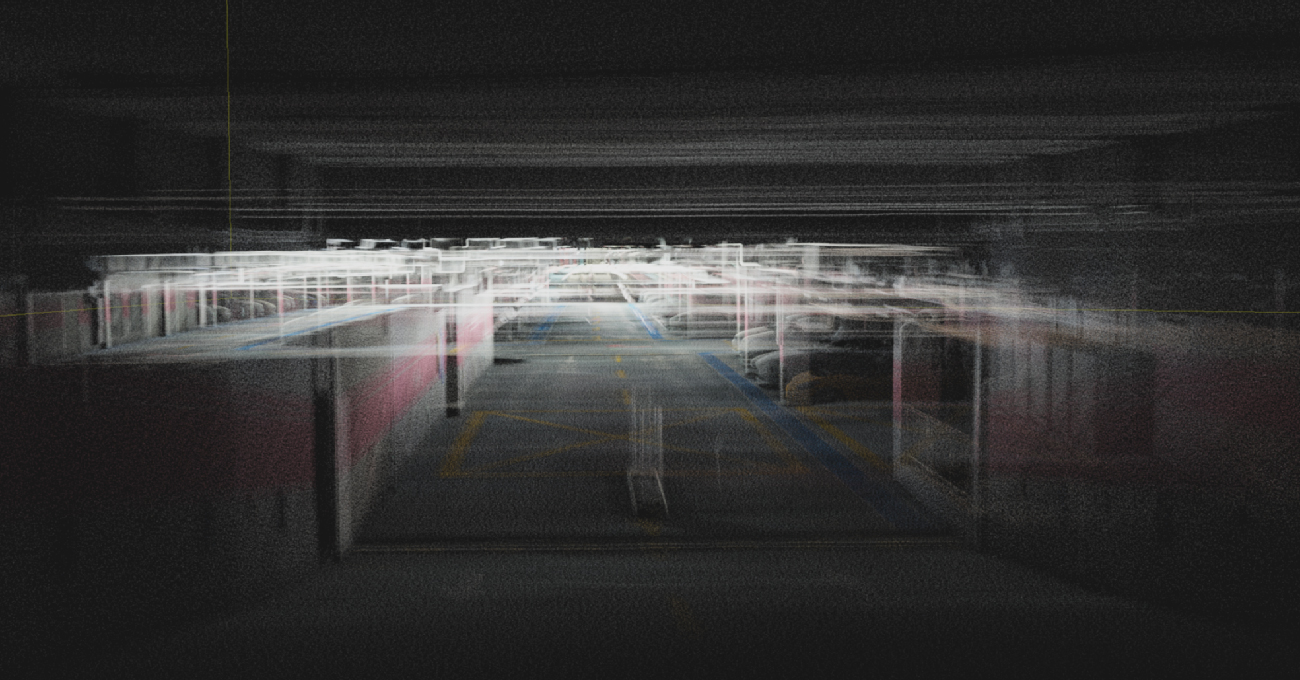
Map the unreachable with confidence. Navigate complex GNSS-denied environments such as tunnels, mines, and utility corridors. The robust SLAM algorithm ensures continuous, drift-free mapping where traditional GPS fails, ensuring safety and data integrity.

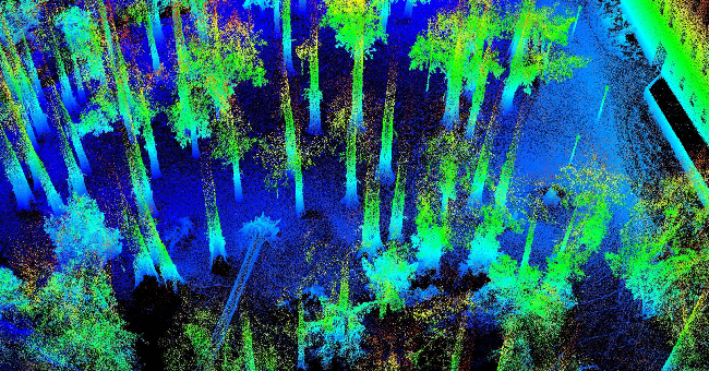
Digitize vegetation with exceptional detail. Efficiently map dense forests to calculate biomass, tree height, and canopy cover. The dual-camera system creates true-color point clouds, making species identification and environmental analysis faster and easier.
Calculate stockpiles instantly and accurately. Replace tedious manual measurements with rapid mobile scanning. Quickly generate accurate 3D models of stockpiles, excavations, and earthworks for precise volume calculations and inventory management.

Streamline facility management and retrofitting. Create high-fidelity digital twins of complex industrial plants and factories. Capture intricate piping, machinery, and structural details to support asset management, layout planning, and maintenance operations.

-
Datasheet_MVP S1_20251208_V1.0
Release Date: 2025-12-08 Version:1.0
-
MVP S1_Brochure_EN_20260104_v1.0
Release Date: 2026-01-04 Version:1.0
-
Brochure_MVP S1_ES
Release Date: 2026-01-12 Version:V1.0